My first globe
December 19, 2006 4:48 pm GeneralRecently, I’ve been seeing a bit more of the world – in recent months, I’ve been to Brazil and Portland, and over the next few months, I’ll be in LA, San José, Brussels and the UK, and probably more.
So now I get to answer questions from my eldest son Thomas like “Is Brazil near school, Daddy?” – I’ve come to realise that Thomas has no sense of the scale of the world.
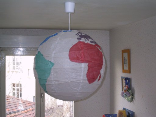
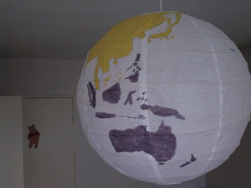
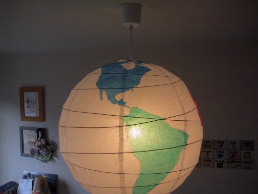
So I decided to make the boys a globe light.

I bought a cheap paper ball light from Ikea and printed out a decent sized map of the world, drew some pencil guide-lines around the tropics, the equator and the arctic circle, and I was off.

One of the things you learn when drawing a map is how little land is below the equator. The really interesting bits are at the top – so much so I almost hung the world upside-down just to see what it would look like.

Another of the things you learn is that you will always draw the bits of the world you know better than the rest (see Europe). Australasia in particular is a pain to draw – what with Japan, Malaysia, the Philippines and Indonesia, it’s just a bunch of these tiny interlocking islands.
Also of note are some controversial colouring decisions – Turkey is in Europe on my globe, and part of Malaysia is in Australasia, while the rest is in Asia. No need to write in about these – they were simply convenience decisions on the spur of the moment.

Another thing you notice when you try to draw things to scale is how stretched Europe and the US are in our classical world maps. I know that there are map types which preserve area, but I guess that we don’t use them much because people aren’t comfortable with how small Europe is.
December 20th, 2006 at 4:08 am
You could also notice that there’s no such thing as hanging the world upside-down
December 20th, 2006 at 4:24 am
I could have painted it upside down…
Dave.
December 20th, 2006 at 6:44 am
“Turkey is in Europe on my globe”
well, yes, but by no mean the eastern shore of the Caspian See is in Europe. Generally, Europe is considered to end with the Ural river and the Caucasus mountains.
December 20th, 2006 at 7:22 pm
Un futur Globe-trotteur le petit Thomas 🙂
December 22nd, 2006 at 10:26 am
According to your coloring scheme, you included the middle east as a part of Africa. It isn’t, its a part of Asia. I should know since i live in Lebanon.
December 24th, 2006 at 5:13 am
Bravo pour cette belle réalisation.je pense que Thomas et Paul vont connaître plus facilement l’ensemble du monde.
Dave tu devrais mentionner avec de belles fléches Lyon,Benghor Mayo, Marseille comme cela les enfants pourront apprécier les distances.
Quant au Père Noël dis à Thomas qu’il lui faut quelques heures pour faire Lyon Marseille. Même avec de grandes bottes il lui faut du temps.
A très bientôt
Grosses bises
Papoune
December 24th, 2006 at 6:21 am
Congratulations but you could write in french please
Bye bye
Geneviève